Explore Surrey’s top traffic hotspots in 2025. Learn what’s causing congestion and how to plan smarter commutes around the city’s busiest intersections.
Navigating Surrey’s Traffic Hubs
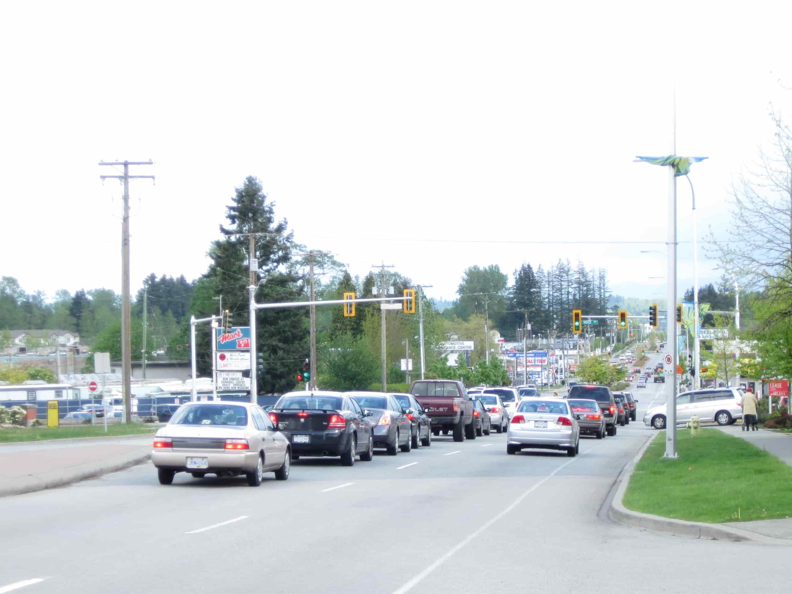
As Surrey continues to grow as one of British Columbia’s fastest-developing cities, traffic volumes have steadily increased across key intersections. With major development projects, population surges, and transit expansion, certain parts of the city are seeing heavier congestion than ever in 2025.
Whether you’re a daily commuter or a local business owner, understanding where delays occur most can help you better plan your routes—and avoid unnecessary frustration.
Top Congested Intersections in 2025
According to recent city traffic flow reports and commuter data, the following intersections are seeing the highest vehicle volumes and delays this year:
- King George Boulevard & 88 Avenue: A central north-south corridor meeting a busy east-west arterial road. Regular bottlenecks during both morning and evening rush hours.
- Fraser Highway & 152 Street: With ongoing construction for the Surrey-Langley SkyTrain, traffic detours and lane reductions are impacting this intersection significantly.
- 104 Avenue & 140 Street: Near major shopping and school zones, this spot often sees congestion during school pick-up times and weekends.
- Highway 10 & 152 Street: Heavy truck movement and commercial access routes make this a key pressure point for both local and regional traffic.
- 64 Avenue & 120 Street (Scott Road): Serving commuters travelling between Surrey and Delta, this intersection sees long wait times during cross-city rushes.
What’s Behind the Delays?
Several factors contribute to congestion at these hotspots:
- Population Growth: Surrey’s population is expected to surpass 650,000 soon, putting more vehicles on the roads daily.
- Transit Infrastructure Projects: SkyTrain extensions and road improvements are causing temporary—but necessary—delays.
- Increased Commercial Activity: With Surrey’s rapid development, areas near industrial zones and commercial centres are seeing more logistics and delivery traffic.
What Drivers Can Do
To minimize delays and stress, drivers are encouraged to:
- Check real-time traffic apps like Google Maps or DriveBC before heading out.
- Travel during non-peak hours when possible.
- Use alternate routes like 128 Street or 76 Avenue to avoid known chokepoints.
- Consider transit options if travelling through high-congestion zones during peak times.
Looking Ahead
Surrey city officials have acknowledged the growing traffic concerns and continue to invest in road upgrades, smart traffic signal systems, and expanded transit services. While 2025 presents its challenges, many of the current disruptions are linked to long-term improvements.
As the city evolves, staying informed and flexible will be key to getting around efficiently.


Leave a comment